Geoglify
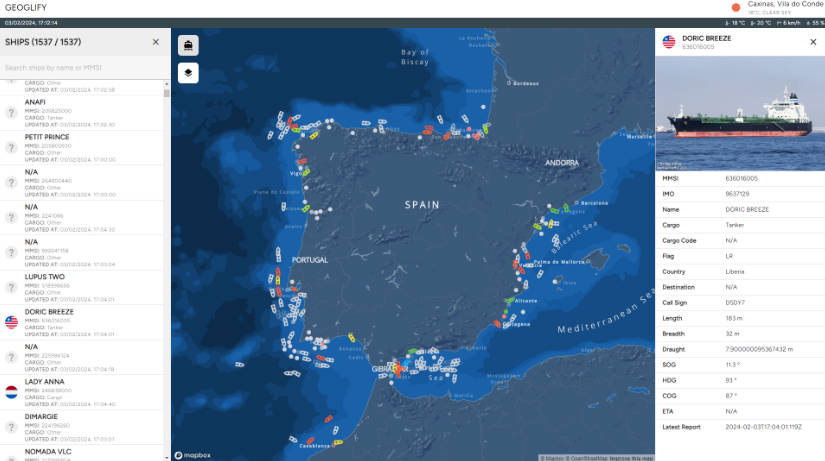
Geoglify, an innovative open-source project dedicated to exploring the vast world of ships, maritime data, planning, and related statistics. Within this repository, you'll find a diverse array of geospatial tools and resources designed to facilitate exploration and deep understanding of the maritime domain within GIS space.
Geoglify offers a comprehensive platform for researchers, developers, and enthusiasts to delve into various aspects of the maritime universe. Whether you're interested in analyzing shipping routes, studying maritime traffic patterns, or investigating environmental impacts, Geoglify provides the tools and data necessary to support your endeavors.
features
Maritime Data Visualization: Future plans to develop interactive visualizations showcasing data on ships, maritime routes, oceanic conditions, and more.
Enhanced Maritime Planning: Ongoing efforts to build tools that will assist in efficient route planning, fleet management, and resource optimization in the naval industry.
Comprehensive Industry Statistics: Future development to provide up-to-date statistics on maritime traffic, types of vessels, weather patterns, and other relevant factors.
Extended Maritime Data APIs: Plans for seamless integration with APIs that will offer real-time data on sea conditions, ship locations, and other crucial information.
License
This project is licensed under the MIT License